Integrating Technology with Community Wisdom

Participatory community research to increase participation of marginalised citizens in the process of smart city development

Role

Project Coordinator

Role

Project Coordinator

Role

Project Coordinator

Organisation

Samarthan

Organisation

Samarthan

Organisation

Samarthan

Timeline

4 Months

Timeline

4 Months

Timeline

4 Months

Project Background

In rapidly developing cities across India and other emerging nations, infrastructure upgrades often overshadow the voices of smaller communities and settlements amidst promises of city-wide benefits. The Community Embedded Decision Support Systems (CEDSS) pilot project in Bhopal, India, aimed to address this disparity. Supported by the EU, this pilot initiative focused on helping residents of Banganga, a slum settlement, through a participatory, technology-driven approach to urban planning. The project aimed to generate Second-Order Solutions (SoS) tailored to the community's specific needs by integrating local insights and knowledge with advanced geospatial and technological tools.

An international, crossdisciplinary collaborative effort

The project was a combined effort between multiple international Institutes. It was led by the Institute of Development Studies, Sussex as the central knowledge partner, the Group for Analysis of Development (GRADE), Chile, was the technical Partner while Samarthan, with its community expertise was the on-field community partner. It was also crucial for us to work with Smart City Development officials to show them the solutions and collaborate in technical efforts.

If you’re someone who prefers watching videos over reading, here’s a detailed one about the project that thoroughly covers its various aspects

If you’re someone who prefers watching videos over reading, here’s a detailed one about the project that thoroughly covers its various aspects

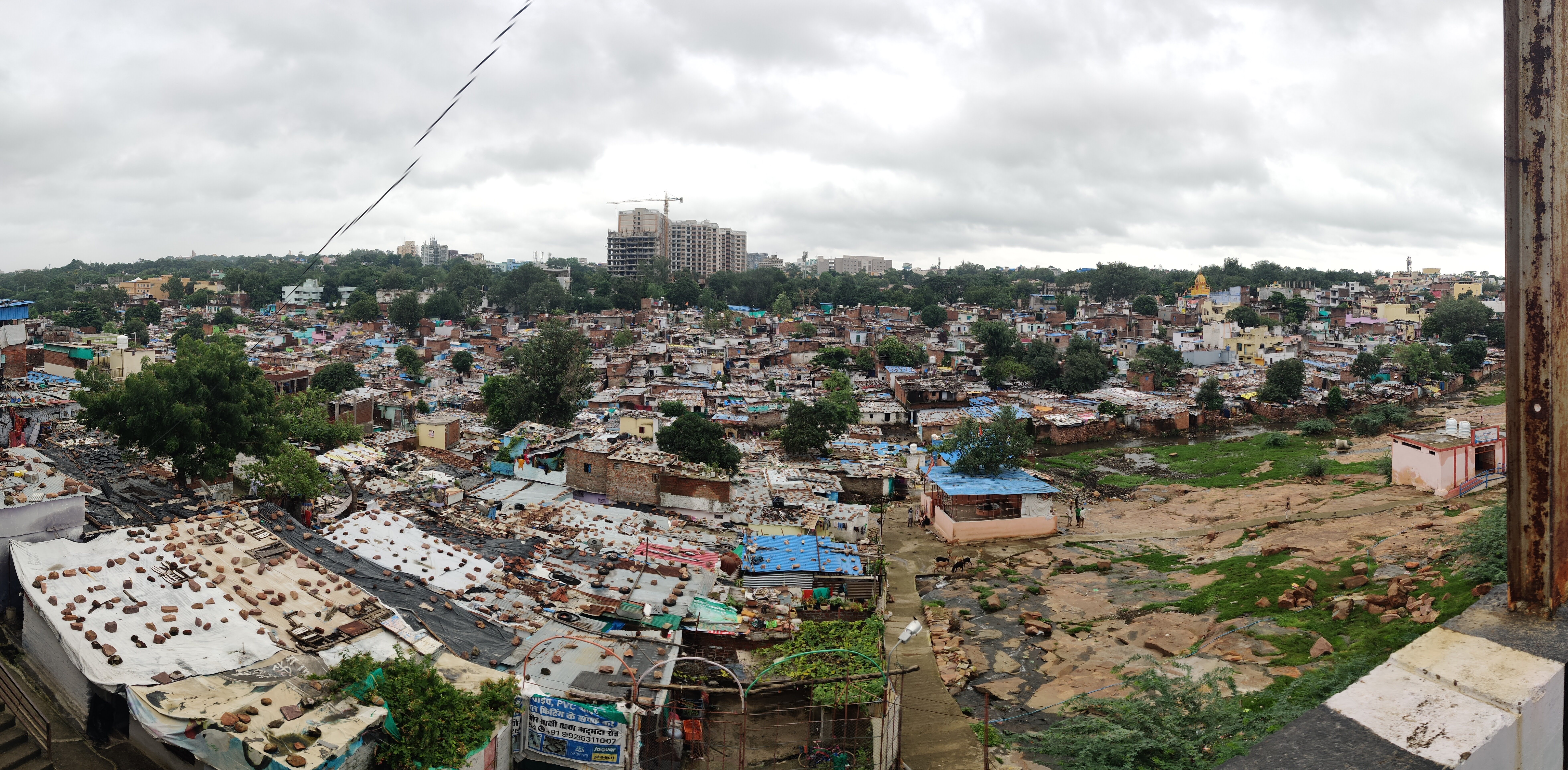
Banganga: Battle of a slum versus the smart city

Banganga was chosen for the CEDSS pilot due to its central location in Bhopal and proximity to Smart City developments. Recent Smart City road projects, while improving overall city connectivity, have disrupted established pathways for Banganga residents, increasing travel times and creating barriers to essential services like healthcare, schools, and markets.

a cell phone on a table
a cell phone on a bench
a cell phone on a ledge

Using Participatory tools to get community data

Participatory Rural Appraisal Tools were used to help community articulate their challenges and needs in a participatory manner.

  • Community consultations using a focus group discussions were essential tool to understand the socio-cultural and political differences between communities and create a space that allows people to talk about their personal and collective everyday struggles in multidimensional ways.


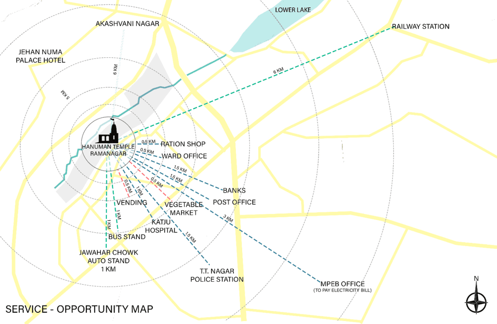
  • Coming from an architecture background, I knew mapping exercises will prove very effective, so we created Service opportunity maps, and resource maps which were essential in understanding social boundaries and economic opportunities for residents.

a cell phone on a bench

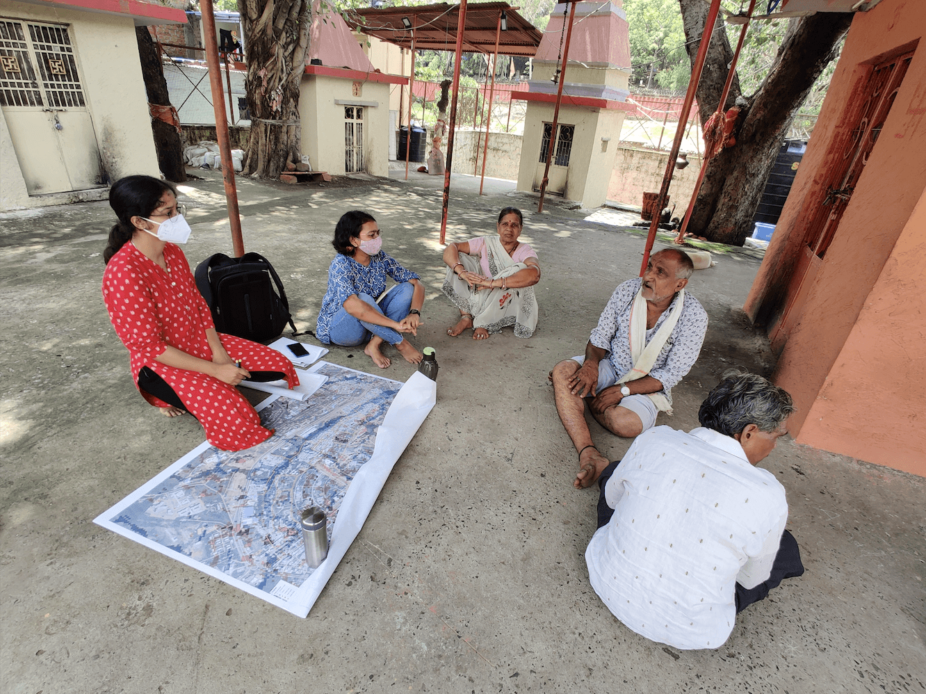
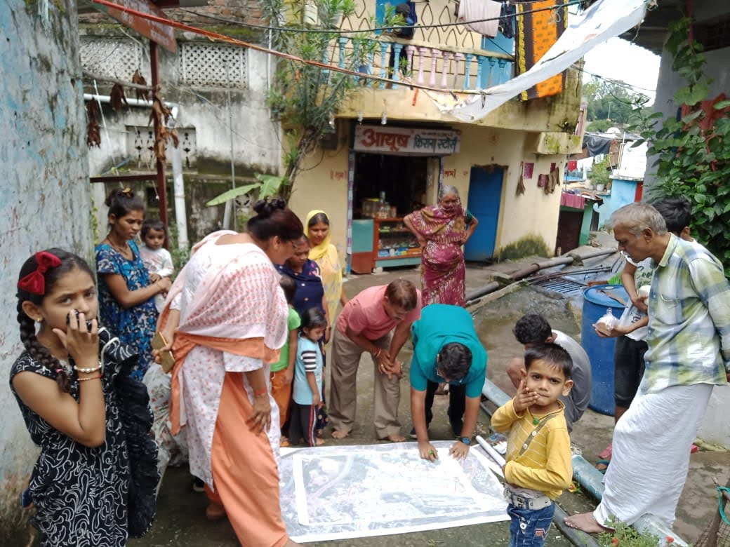
Creating participatory maps with community members

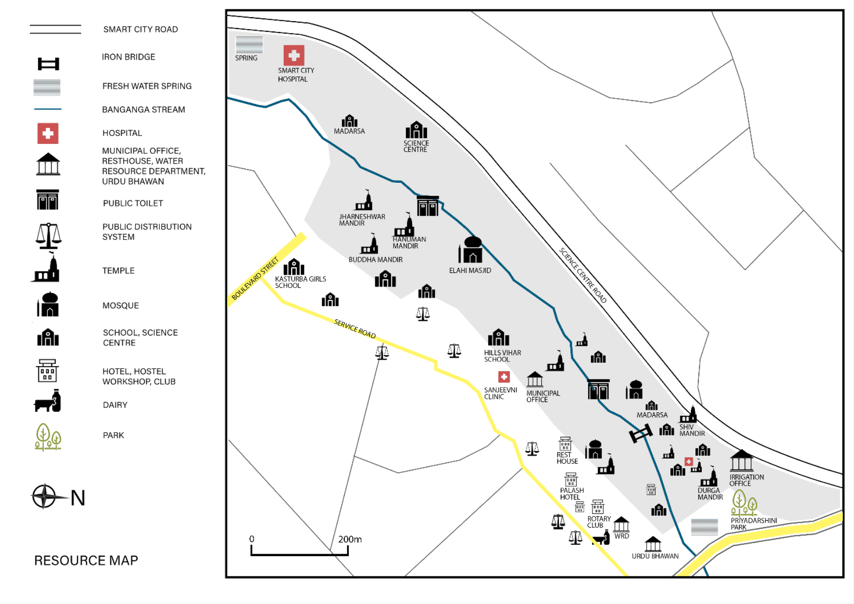
Synthesis of Community and geo-information data to form second-order solutions

The data gathered by and of the community was shared with our technological partners at GRADE, who overlaid it on GIS data layers. GIS tools transformed this raw data into actionable intelligence, allowing us to map physical spaces as well as social dynamics and community aspirations. Through this data design solutions that addressed both tangible infrastructure needs and intangible community goals were created.

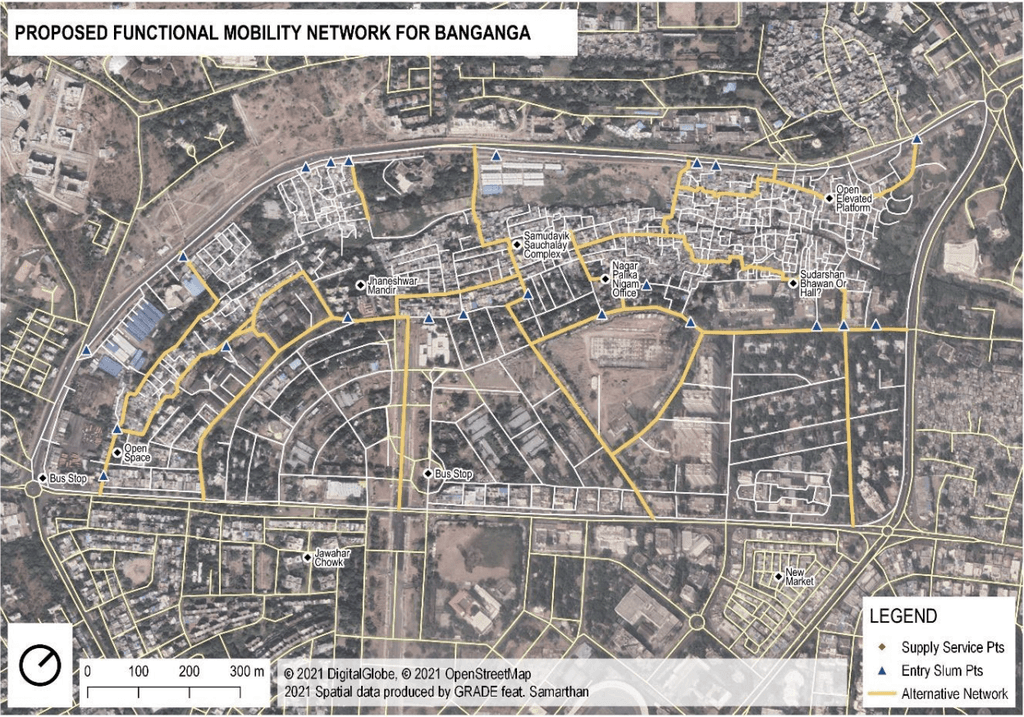
Presenting second order solutions

The data gathered by and of the community was shared with our technological partners at GRADE, who overlaid it on GIS data layers. GIS tools transformed this raw data into actionable intelligence, allowing us to map physical spaces as well as social dynamics and community aspirations. Through this data design solutions that addressed both tangible infrastructure needs and intangible community goals were created.

Presenting solutions and getting feedback

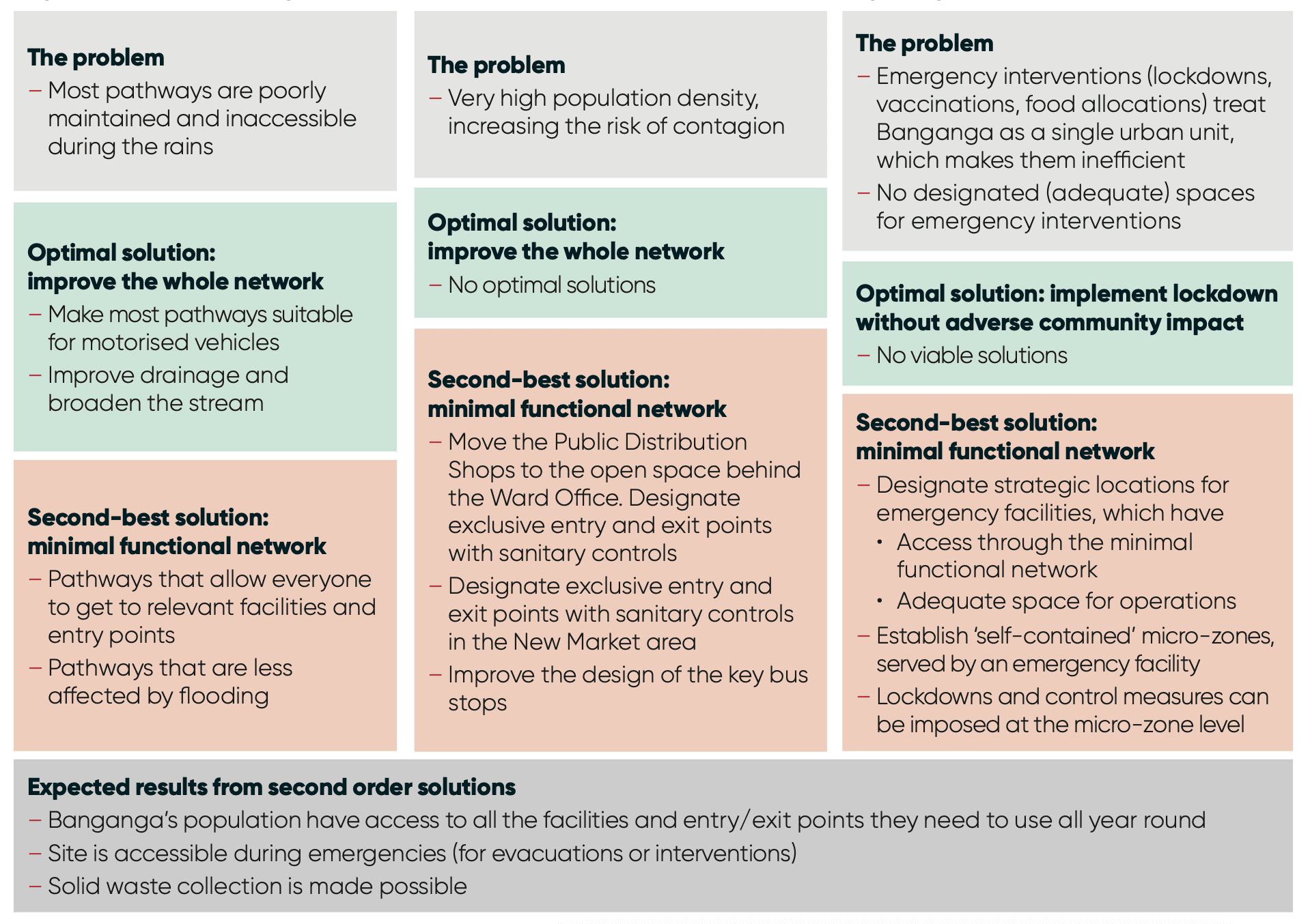
Co-designed second order solutions in Banganga ; Author - IDS Sussex

An informed, scalable soution emerges

The CEDSS project is an important example of leveraging technology for community-centric solutions through collaboration across disciplines. This model has potential to be replicated across different spaces to identify solutions at either ward or city level. Although technical experts can propose solutions, but it is important that each community plays an active role in redesigning the solutions that are most feasible in their community space.

Kabir Shrivastava

Copyright 2024 by Kabir Shrivastava

Kabir Shrivastava

Copyright 2024 by Kabir Shrivastava

Kabir Shrivastava

Copyright 2024 by Kabir Shrivastava